Moonshine Arch: A Hidden Gem in the middle of Vernal

When I tell people that Justin and I live in Vernal, Utah, I often get a lot of scrunched up noses followed by the question, "Why? What's in Vernal?"
Well, a lot actually. Although very different from Charlottesville, Vernal has it's own desert beauty which puts me in awe of the beautiful world God created for His children. Moonshine Arch is one of those beautiful gems hidden smack dab in the middle of Vernal.
Justin, Lucy, and I decided to explore this hidden gem on Saturday and it turned out to be the perfect day to just pack up and go. The sun shone but, being April, we had a nice breeze to cool the 2.4 mile, round trip hike.
The best part, too, is that once you reach the arch it is such a fun place to let the kids go wild. They can climb to the top side of the arch, play in the sand or explore to their hearts content.
Check out our first hike of the season below!
More information on the hike and directions are below the photos.


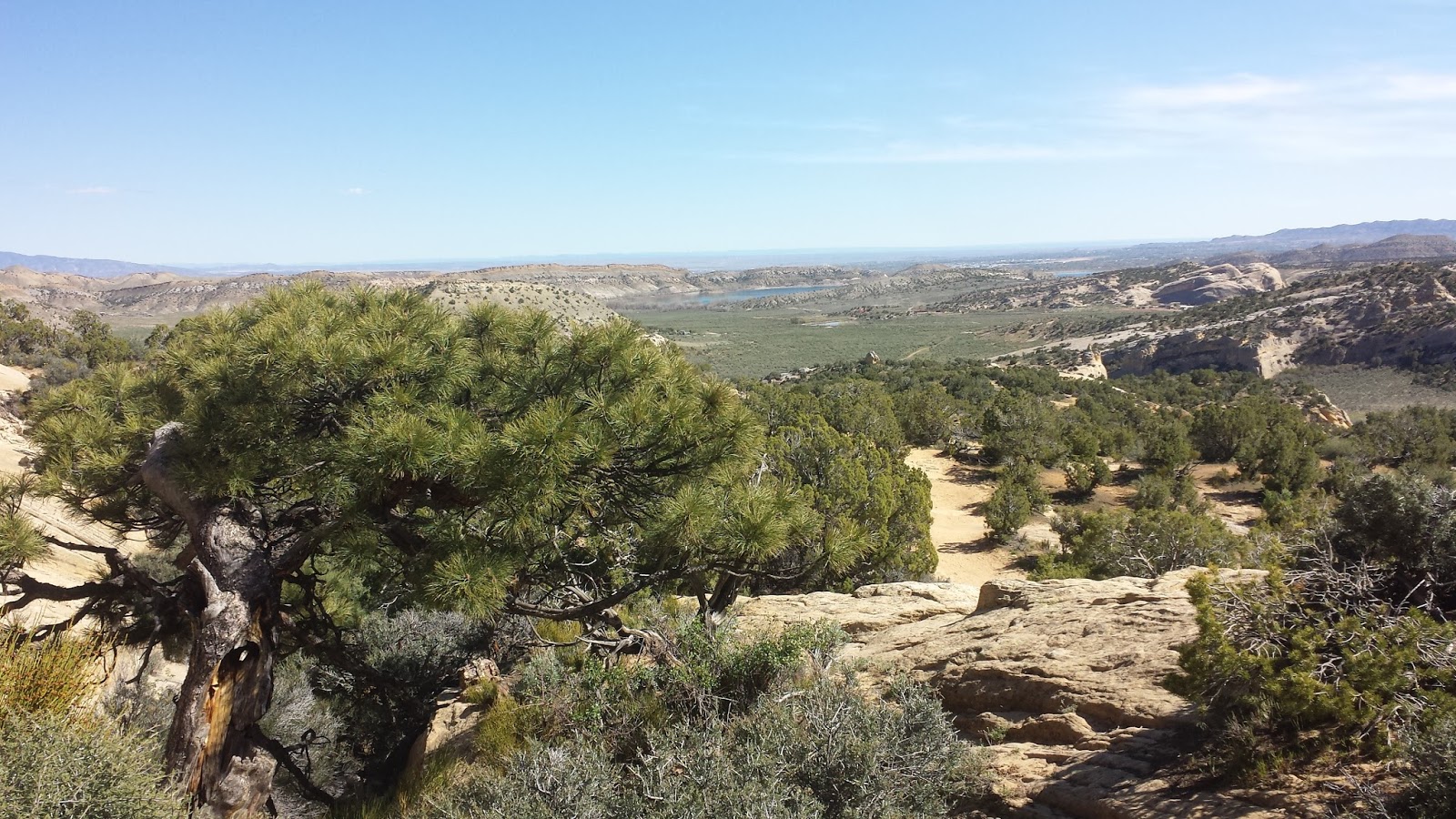
View from the top of the arch: Uintah Basin

Hike Specs:
- Difficulty: Easy
- Length: 2.4 miles
- Proximity: 15 minutes from Main Street
- Trail: Mostly soft sand and smooth rocks so make sure to wear close-toed shoes with good grips
We hiked to Moonshine Arch at 26 weeks pregnant (6 months) and were fine. Many other hikers had kids and one couple even pushed their stroller up the mountain to the arch so it's very easy. I would definitely recommend taking a water bottle for each person in your group and a camera because you'll want photos of the beautiful scenery!
Directions to Moonshine Arch:
GPS led us astray as we tried to find the trail head to Moonshine Arch resulting in some nice, long scratches along the side of our Honda Accord. The road getting to Moonshine Arch is a bit rough and can be traveled better with a larger vehicle with a higher clearance, but we still made it fine.
Take highway 191 north past Main Street for a couple of miles. You'll pass the Uintah Nursery on your right toward Steineker State Park. Continue following the highway for about a 0.5 mile past the entrance (and sign) to Steineker State Park. On the left there is a hidden dirt/gravel road just as you reach the middle of the curve in the road. Keep an eye out because it is fairly difficult to see. Turn left onto the dirt/gravel road and follow it down the bend. You'll cross a covered wash before reaching a gate, which you should pass through. Take your second left onto another dirt road with the sign "Moonshine Arch".
Do Not take the first dirt road you come to on the left without the sign. We did this and had some damage to our car before figuring out how to U-turn with difficulty to get out. Take the second dirt road, which is much wider and the ground looks less rough than the first.
Continue on the labeled dirt road for approx. 1 mile until you reach a green fence and parking area.
This is the trail head although there isn't a sign. Begin your hike staying to the right heading down the ravine. At the first fork in the road, take a right and then continue on the trail. The hike is about 1.2 miles up... if you get confused (because there aren't many signs) just follow the plethora of feet print in the sand.
Note: If the weather has been wet, you will likely need a vehicle with four wheel drive.
Enjoy your trip to Moonshine Arch!

Comments
Post a Comment